
Camera drones designed for environmental monitoring range from compact, beginner-friendly models like the DJI Mini 4K starting around $300 to professional-grade systems that deliver extended flight times and multi-camera setups for comprehensive documentation. The right choice depends on your specific monitoring needs: whether you’re tracking seasonal changes in Chesterfield’s conservation lands, documenting wildlife corridors, or assessing water quality in local streams and wetlands.
The environmental work you’re planning determines which features actually matter. Flight time becomes critical when covering large survey areas or waiting for wildlife to appear. Sensor size directly affects image quality in the varied lighting conditions you’ll encounter outdoors, from dense forest canopy to bright reflective water surfaces. Weather resistance separates cameras you can fly on schedule from ones that keep you grounded half the season.
Local environmental groups in the Monadnock region have learned these lessons through trial and error. The volunteers monitoring vernal pools near Pisgah State Park initially chose ultra-compact models for portability, but quickly discovered that 20-minute flight times meant multiple battery swaps per site visit. Meanwhile, the team documenting invasive species spread opted for models with larger sensors, finding that the improved low-light performance made early morning and late afternoon flights far more productive.
This guide walks you through the key specifications that matter for outdoor monitoring work, compares drone categories suited to different environmental applications, and reviews eight current models including the DJI Mini 4K, DJI Mini 3 Fly More Combo With DJI RC and several versatile options for adults and beginners. You’ll also find targeted recommendations for specific monitoring scenarios and common purchasing mistakes that waste money without improving your documentation capabilities.
What to Look for in a Camera Drone for Environmental Monitoring
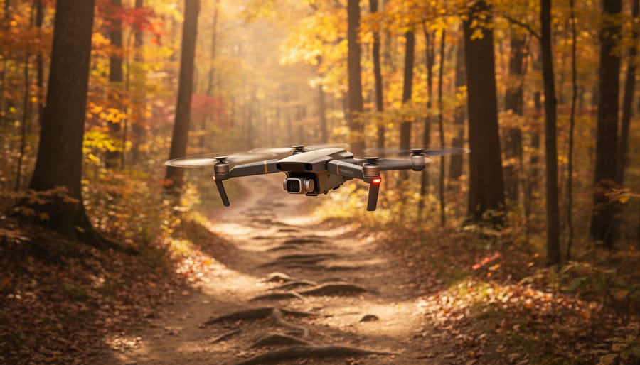
Selecting a camera drone for environmental monitoring requires balancing technical specifications with the practical demands of fieldwork in New Hampshire’s varied terrain. The right combination of features ensures you can capture reliable data whether you’re documenting wetland changes near Spofford Lake or tracking seasonal shifts in Pisgah State Park’s forests.
Camera sensor quality determines whether your monitoring footage will reveal the details you need. A 1-inch sensor captures significantly more light and detail than smaller sensors, which matters when you’re documenting subtle environmental changes or identifying wildlife species from altitude. Resolution alone doesn’t tell the whole story; a 4K camera with a small sensor will struggle in the early morning light that’s often ideal for wildlife observation. Look for sensors that perform well in varying light conditions, since you can’t always schedule monitoring sessions for perfect midday sun.
Flight time directly affects how much ground you can cover in a single session. A drone with 25 minutes of flight time might seem adequate until you factor in the five-minute hike to your monitoring site, the time needed to set up your shot, and the battery drain from flying against Chesterfield’s occasional winds. Models offering 35 to 45 minutes give you the buffer needed for thorough documentation without constant battery swaps in the field. Keep in mind that advertised flight times assume calm conditions; real-world performance in New Hampshire weather will be shorter.
Weight regulations matter more than many first-time buyers realize. Drones under 249 grams avoid certain FAA registration requirements and restrictions, making them attractive for casual monitoring. However, this weight class often sacrifices camera quality and wind resistance. Heavier drones handle gusty conditions better but require registration and more careful attention to flight restrictions. Understanding outdoor safety drones regulations helps you choose a weight class that matches your monitoring ambitions.
Weather resistance shouldn’t be overlooked if you’re serious about year-round monitoring. New Hampshire delivers everything from humid summer mornings to sudden autumn squalls. While most consumer drones aren’t waterproof, models with better sealing and moisture resistance handle light mist and temperature swings more reliably. IP ratings provide a standardized measure of protection, though you’ll find these specifications mainly on professional-grade models.
Range and transmission quality determine whether you can monitor larger areas or must stay close to your launch point. A 10-kilometer transmission range sounds impressive, but terrain and interference reduce effective range. For work in Chesterfield’s wooded areas, prioritize signal reliability over maximum distance specs. Obstacle avoidance sensors add a safety margin when you’re focused on framing a shot rather than navigation.
Battery life goes beyond single-flight endurance. Consider the total number of batteries you’ll need for a monitoring session and how quickly you can recharge them in the field. A drone with three batteries and 30-minute flight times gives you more working flexibility than one with a single 45-minute battery, especially when you’re hours from a power source.
Understanding Different Types of Camera Drones
Camera drones fall into four main categories, each suited to different environmental monitoring tasks and skill levels. Understanding these distinctions helps you match equipment to your specific field work in Chesterfield’s varied terrain.
Lightweight Mini Drones (Under 249g)
These compact models offer simplified FAA registration requirements and minimal setup time. Mini drones like the DJI Mini 5 Pro pack advanced features into a portable frame, with 1-inch sensors and dual cameras delivering excellent image quality for trail documentation and seasonal change tracking. Their 36-minute flight time covers most observation tasks, while the sub-250g weight means you can launch quickly when wildlife appears. The light build does make them more susceptible to wind, something to consider during New Hampshire’s breezy autumn afternoons.
Mid-Range Models with Advanced Sensors
Mid-range drones balance capability and portability. The DJI Air 3S exemplifies this category with dual cameras, a 1-inch main sensor, and 45-minute flight time. These models handle complex monitoring scenarios like water quality surveys at Spofford Lake, where you need both wide-area coverage and close-up detail. They tolerate moderate wind better than mini drones and offer obstacle avoidance sensors that protect your investment when navigating forest canopies.
FPV Drones for Dynamic Monitoring
First-person view drones like the DJI Avata 360 excel at immersive documentation and forest fire monitoring where you need to maneuver through tight spaces or capture dramatic perspectives. The 8K 360-degree capability creates comprehensive environmental records. However, FPV systems require more piloting skill and work best for experienced operators conducting specialized surveys rather than routine observation.
Professional-Grade Platforms
Premium models like the DJI Mavic 4 Pro deliver research-level data with three-camera systems, 4/3 sensors, and 51-minute flight times. The multi-lens configuration lets you switch between wide landscape views and telephoto wildlife shots without changing position. These platforms suit serious environmental documentation projects where image quality and extended range justify the investment.
| Drone Type | Best Monitoring Use | Weight Class | Typical Flight Time |
|---|---|---|---|
| Lightweight Mini | Wildlife observation, trail surveys | Under 249g | 30-36 minutes |
| Mid-Range Advanced | Water quality, terrain mapping | 249-900g | 40-45 minutes |
| FPV | Forest navigation, emergency response | Varies | 20-30 minutes |
| Professional-Grade | Research projects, long-range surveys | 900g+ | 45-51 minutes |
Beginners should start with lightweight or mid-range models that offer automated flight modes and collision avoidance. The simpler controls let you focus on observation rather than piloting mechanics. As your skills develop and monitoring needs become more specialized, you can upgrade to FPV or professional systems that offer greater control and data quality.
DJI Mini 4K Drone

The DJI Mini 4K strikes an ideal balance for outdoor enthusiasts just starting their environmental monitoring journey in Chesterfield. Weighing under 249 grams, this drone keeps you clear of FAA recreational registration requirements, letting you focus on documenting wildlife along the Ashuelot River or tracking seasonal changes in the surrounding forests without administrative hurdles.
The 4K UHD camera delivers surprisingly sharp footage for a sub-250g platform. When you’re hovering over Spofford Lake to check water clarity or capturing deer movement patterns near the town forest trails, that resolution gives you enough detail to zoom in during review and spot important changes you might miss with lower-quality sensors. The three-axis gimbal stabilization keeps your footage steady even when New Hampshire’s unpredictable breezes kick up, which matters tremendously when you’re trying to document subtle environmental shifts or compare footage across multiple visits.
Flight time sits around 31 minutes per battery under calm conditions, though expect closer to 25 minutes when you’re working against wind or climbing elevation. That’s enough for a thorough survey of a trail section or monitoring transect before you need to land and swap batteries. The transmission range extends up to 10 kilometers in open areas, giving you plenty of reach for following wildlife corridors or surveying larger parcels.
Beginners appreciate the straightforward controls and QuickShots automated flight modes. Point the camera at a vernal pool you’re monitoring, tap a preset flight path, and the Mini 4K handles the piloting while you focus on what you’re documenting. With over 4,000 customer ratings averaging 4.4 stars, real-world users confirm this drone handles field work reliably without the learning curve that intimidates newcomers to environmental documentation.
DJI Mini 4K Camera Drone Combo

The DJI Mini 4K Camera Drone Combo extends the standalone model’s capabilities with practical additions that matter for extended environmental monitoring sessions in Chesterfield’s backcountry. The package includes two intelligent flight batteries that deliver a combined 62 minutes of flight time, letting you cover more ground during a single outing without returning to your vehicle for battery swaps. That extra airtime proves valuable when you’re documenting seasonal migration patterns along the Connecticut River corridor or surveying trail erosion across multiple access points in a single field trip.
The 10km video transmission range gives you genuine freedom to monitor distant features without losing live feed or control, particularly useful when observing wildlife behavior in the Pisgah State Park wilderness where maintaining visual line-of-sight can be challenging through dense canopy. You’ll maintain stable connection while tracking deer movement through ridge systems or documenting beaver dam construction in remote wetlands.
QuickShots automated capture sequences handle repetitive documentation tasks efficiently. The Dronie, Circle, and Helix modes create consistent footage for comparing monitoring sites over time, while Rocket provides vertical perspectives for assessing forest health or documenting seasonal flooding extents. These pre-programmed flight paths free you to focus on observation rather than piloting, especially helpful when you’re simultaneously managing offline trail navigation equipment and field notes.
The Combo package currently holds a 4.2 out of 5 rating from 1,945 customer reviews and remains in stock. For serious environmental documentation work beyond casual weekend observation, the dual batteries and extended transmission justify the step up from the basic package, particularly if you’re monitoring multiple sites during single field sessions.
Drone with Camera for Adults 2K

Budget-minded environmental enthusiasts can dip into drone monitoring with the 2K HD FPV model, which trades premium features for accessible entry pricing. The 2K camera delivers enough resolution for general wildlife tracking and trail documentation around Chesterfield’s conservation areas, though you’ll notice softer detail when zooming into footage compared to 4K systems. Altitude hold keeps the drone steady over monitoring sites without constant throttle adjustments, letting you focus on framing shots of seasonal vegetation changes or stream conditions rather than wrestling with controls.
Two included batteries extend your field sessions, essential when you’re hiking to remote observation points and can’t easily return for a swap. One-key takeoff and landing remove the trickiest parts of flight for beginners, while speed adjustment lets you slow down for delicate maneuvers near tree canopies or speed up when repositioning between monitoring zones. Headless mode simplifies orientation during data collection, particularly useful when tracking moving wildlife.
The limitations become clear against professional rigs. Wind resistance falls short in New Hampshire’s exposed hilltops, transmission range restricts how far you can venture from your position, and the camera sensor struggles in low-light forest conditions where wildlife activity peaks at dawn and dusk. Think of this as a learning platform for casual observation rather than systematic research. It pairs well with AR trail guides for multimedia trail documentation but won’t replace dedicated environmental monitoring equipment for serious conservation work.
Drone with Camera Screen
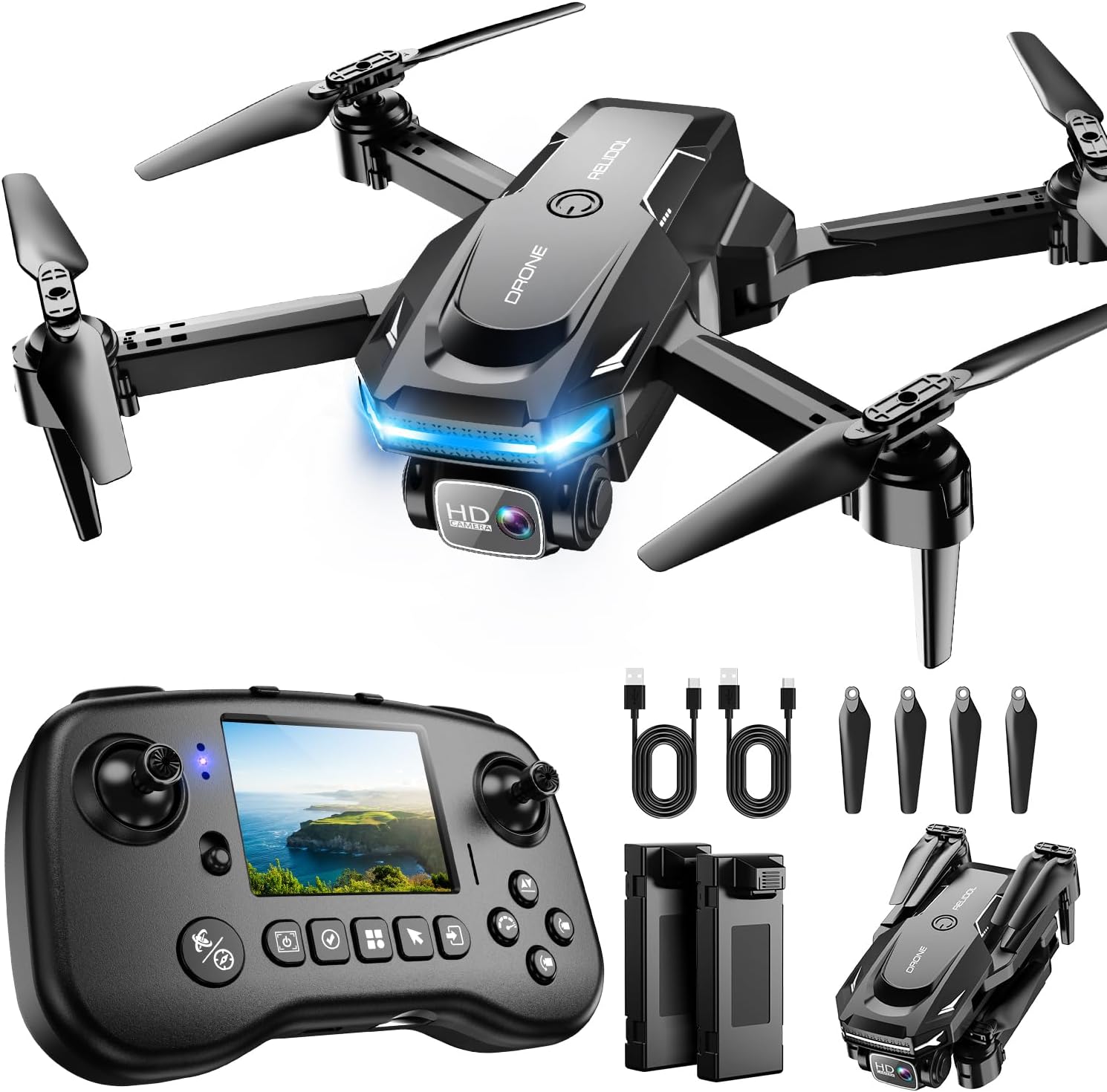
For environmental monitoring work in the field, a drone with an integrated screen on the controller eliminates a common frustration: scrambling to mount your phone in bright sunlight or dealing with connectivity glitches when you’re miles from the trailhead. This model puts real-time FPV (first-person view) footage directly on the controller screen, letting you monitor forest canopy changes, track animal movement patterns, or survey stream conditions without relying on a separate device that might die, overheat, or lose signal at the worst moment.
The quadcopter design provides stable hovering over monitoring sites, essential when you’re documenting subtle environmental indicators like water clarity or vegetation health. You can hold position above a wetland to capture consistent comparison footage across visits, or follow a deer trail through dense woodland while maintaining visual contact through the onboard screen. The FPV capability means you see exactly what the camera sees in real time, crucial for framing wildlife shots or positioning the drone to capture erosion patterns along a streambank.
Practical considerations matter for outdoor surveys around Chesterfield. The built-in screen works in variable weather where touchscreens fail, though you’ll still want to check battery performance in cold New Hampshire winters. The controller’s dedicated display draws power, so plan flight times accordingly during extended monitoring sessions. For researchers documenting seasonal changes across multiple sites, the phone-free operation speeds up deployment at each location, no pairing delays, just power on and fly.
With 4.3 out of 5 stars from over 1,000 users and current availability, this option suits environmental enthusiasts who value field reliability over premium features.
2K HD FPV Drone with Camera for Adults

This portable, foldable 2K FPV model stands out for environmental enthusiasts who need a drone that slips into a daypack for backcountry monitoring work. The compact design makes it practical for hikes into Chesterfield’s forested areas where you’re already carrying field notebooks, water quality test kits, or camera gear.
The three speed modes prove useful in real monitoring scenarios. Low speed works well when you’re documenting slow-moving wildlife near Spofford Lake’s shoreline and need precise positioning. Mid-range suits general aerial surveys of trail conditions or seasonal vegetation changes. The fastest mode helps you relocate quickly when tracking migrating birds or covering larger watershed areas before battery depletion.
Headless mode addresses a common frustration during environmental data collection. When you’re focused on framing a shot of stream erosion patterns or documenting invasive plant spread, the drone maintains orientation relative to your position rather than its own nose direction. This simplifies navigation when you’re simultaneously managing field notes and tracking wildlife behavior.
The dual batteries extend viable monitoring time, though you’ll still need to plan your documentation runs carefully. The 2K camera resolution provides adequate detail for most environmental observation tasks like counting waterfowl on Mirror Lake or recording phenology changes in maple stands, though serious researchers documenting minute plant structures may want higher resolution.
For entry-level environmental enthusiasts exploring monitoring techniques around Chesterfield without significant investment, this drone offers a practical starting point. The foldable design and straightforward controls let you focus on learning documentation methods rather than complex flight mechanics.
Drone with Camera LCD Screen RC FPV Drone with Brushless Motor

The brushless motor design in this compact system shifts the field-work experience from hobby-level buzzing to something closer to professional-grade observation. Where traditional motors announce your presence across the clearing, brushless architecture runs cooler and quieter, a meaningful advantage when you’re positioning over a beaver pond at dawn or hovering near nesting areas without flushing birds. The efficiency gain also translates to longer air time per charge, stretching your monitoring window before swapping batteries.
The integrated LCD screen on the controller solves a persistent frustration with smartphone-dependent setups: glare washing out your display when the New Hampshire sun breaks through the canopy, or cold-numbed fingers fumbling to mount a phone at a windswept ridgeline. You power up, the screen lights immediately, and you’re reviewing your framing without pulling a second device from your pack. For quick checks of trail conditions or erosion patterns along the Ashuelot River, this streamlined workflow keeps you moving efficiently.
UHD video captures fine detail that proves useful when you’re documenting subtle environmental changes, sediment buildup at stream confluences, canopy health across seasons, or ice formation stages on Spofford Lake. The 360° flip capability, while more gimmick than tool for serious monitoring, does let you recover quickly from gusty crosswinds that tip the drone, maintaining your position over the survey site without restarting the flight.
SD card support means you can swap cards mid-session rather than offloading footage to a laptop between flights, a practical advantage during multi-day backcountry surveys. At under 250 grams, the drone avoids FAA registration requirements, simplifying deployment logistics when you’re already juggling field notebooks, water-testing kits, and camera gear on the trail.
Drone with Camera for Adults Beginners Kids

This 1080P foldable mini drone offers an accessible entry point for families wanting to document Chesterfield’s trails and wildlife together without overwhelming technical complexity. The one-key start function makes launches straightforward at trailheads or lakeside observation spots, letting you focus on framing your subject rather than mastering intricate control sequences. Once airborne, altitude hold keeps the drone stable for steady observation of deer movements through meadows or bird activity along the Ashuelot River, even when younger family members are at the controls.
The dual battery setup extends your monitoring time during single outings, which matters when you’re hiking to remote spots and want to capture multiple vantage points before heading back. You can document a woodland trail in morning light, swap batteries, then film the same stretch from a different angle to show erosion patterns or seasonal wildflower growth. The foldable design fits easily into backpacks alongside water bottles and field guides, making it practical for spontaneous documentation when you spot something worth recording.
Indoor flight capability lets families practice basic maneuvers at home before attempting outdoor environmental surveys, building confidence and reducing the learning curve. The 3D flip feature adds entertainment value for younger participants while teaching spatial awareness and control precision. With a 4.4 out of 5 rating from 830 customers and current in-stock availability, this model balances affordability with enough functionality for casual monitoring projects around local conservation areas and family nature outings.
DJI Mini 3 Fly More Combo With DJI RC

The DJI Mini 3 Fly More Combo with DJI RC represents a serious investment for environmental researchers who’ve outgrown entry-level drones and need reliable performance across extended monitoring sessions. This package earns its premium position through a combination of practical field advantages that matter when you’re documenting seasonal wetland changes at Spofford Lake or tracking wildlife patterns across Chesterfield’s conservation areas.
Three intelligent flight batteries deliver the monitoring endurance that single-battery systems can’t match. You’ll launch multiple observation flights in a morning session without returning to base camp for recharging, which matters considerably when you’re working on time-sensitive documentation like migratory bird surveys or tracking storm impacts on trail systems. The batteries swap quickly, letting you maintain position over your monitoring site with minimal interruption.
The dedicated DJI RC controller eliminates smartphone dependency entirely. Its built-in screen performs reliably in New Hampshire’s bright summer conditions and cold autumn mornings, conditions that drain phone batteries and wash out standard displays. You’ll frame shots accurately and monitor telemetry data without juggling multiple devices in the field.
Advanced features including obstacle sensing, precise GPS positioning, and intelligent flight modes support sophisticated monitoring workflows. Set waypoint missions to document the same trail sections monthly, or program automated orbits around specific environmental features for consistent comparison data. The Mini 3’s camera system captures detail-rich footage that holds up under analysis, not just casual viewing.
With over 3,100 customer ratings averaging 4.5 stars and current in-stock availability, this combo has proven itself among serious users. It’s substantial financial commitment, but the expanded capabilities match the demands of committed environmental documentation work.
Our Top Recommendations for Different Monitoring Needs
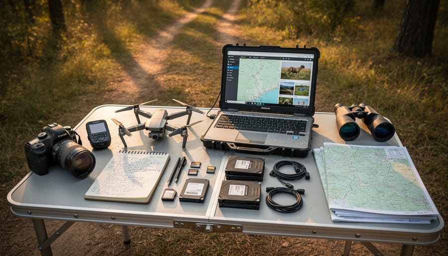
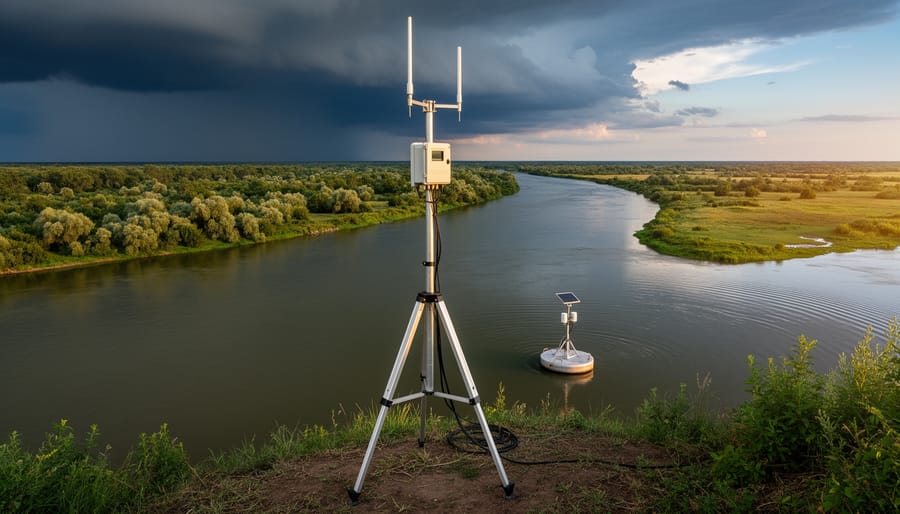
After exploring the features and capabilities of camera drones for outdoor work, choosing the right model comes down to matching its strengths to your specific environmental monitoring goals in Chesterfield and New Hampshire’s diverse terrain.
For wildlife observation in Chesterfield’s forests, the DJI Mini 4K Drone stands out as the ideal choice. Its sub-249g weight means you can launch quickly when you spot wildlife activity without navigating complex registration hurdles, while the gimbal-stabilized 4K camera captures detailed footage of birds, deer, and other animals without the noise and intimidation of larger drones. The compact size lets you maneuver through tree canopies at spots like Pisgah State Park, and the 31-minute flight time gives you enough coverage for a thorough survey session.
Water quality monitoring at Spofford Lake or nearby waterways calls for the DJI Mini 4K Camera Drone Combo. The dual batteries provide 62 minutes of total flight time, essential when you’re documenting conditions across multiple sampling sites in one outing. The 10km video transmission range ensures you maintain visual contact even when monitoring the far reaches of larger water bodies, and the QuickShots feature lets you set up repeatable flight patterns for consistent monthly documentation of shoreline erosion, algae blooms, or waterfowl populations.
- Best for trail condition surveys: Drone with Camera LCD Screen RC FPV, the built-in screen controller eliminates phone dependency on remote trails
- Best budget option: Drone with Camera for Adults 2K, solid 2K quality and dual batteries for casual monitoring under $200
- Best for families: Drone with Camera for Adults Beginners Kids, one-key start and altitude hold make environmental exploration accessible to young naturalists
If you’re committed to serious long-term environmental research projects around Chesterfield, the DJI Mini 3 Fly More Combo With DJI RC represents the best investment. Three batteries support full-day monitoring sessions without interruption, the dedicated controller offers superior range and reliability compared to phone-based systems, and the advanced camera features deliver professional-grade documentation suitable for sharing with conservation organizations or presenting at community meetings. The upfront cost pays dividends when you need consistent, high-quality data collection over multiple seasons.
Common Mistakes to Avoid When Buying Your First Camera Drone
First-time drone buyers for environmental monitoring often overlook FAA registration requirements, which apply to any camera drone weighing between 0.55 and 55 pounds used outdoors, even for non-commercial nature documentation. You’ll need to register through the FAA’s DroneZone portal before your first flight in New Hampshire’s open spaces, and carry proof of registration during field work. Skipping this step can result in penalties and complications if you’re documenting in areas where rangers or conservation officers are active.
Battery life assumptions trip up many newcomers who expect manufacturer-quoted flight times to translate directly to field conditions. Those advertised 30 or 40-minute flight times drop significantly in cold weather, at higher altitudes, or when flying against wind. For reliable environmental monitoring sessions in Chesterfield’s variable conditions, plan on getting about 70% of the rated flight time and budget for at least three batteries if you’re serious about documenting a full trail system or conducting repeated surveys of a monitoring site. Running out of power mid-mission when you’re a mile into the woods wastes the entire trek.
Camera resolution matters more than beginners realize when you’re capturing documentation that you’ll need to review closely later. A 1080p drone might seem adequate until you try to zoom into footage to identify bird species or assess trail erosion details. For environmental work where you’ll analyze imagery after the fact, aim for genuine 4K recording capability with a quality sensor, not just upscaled resolution marketed as 4K.
Weather resistance gets ignored until the first unexpected drizzle ruins an expensive drone. New Hampshire weather changes quickly in the backcountry, and many budget models have zero weather sealing. If you’re monitoring outdoors regularly, invest in a drone with at least some moisture resistance or accept that you’ll be grounded whenever conditions turn marginal.
Range limitations catch people off guard when they move from backyard testing to actual field work across New Hampshire’s expansive landscapes. That 500-meter transmission range feels generous until you’re trying to survey a large wetland or follow a stream corridor. Underestimating range means either incomplete data collection or risky flights where you lose video feed and have to rely on return-to-home features to recover your investment.
Main Options Compared
When choosing a camera drone for environmental monitoring, you’re weighing three primary categories, each suited to different field scenarios and experience levels.
Lightweight Mini Drones (Under 249g): Models in this class offer exceptional portability and simplified regulations since they don’t require FAA registration for recreational use. They’re ideal for quick trail assessments or wildlife observation when you’re hiking Chesterfield’s backcountry. The trade-off? Reduced flight time (typically 25-35 minutes) and less wind resistance in New Hampshire’s exposed ridges.
Mid-Range Prosumer Models: These strike the sweet spot for serious environmental documentation. They deliver robust camera sensors, longer flight times (40-50 minutes), and advanced obstacle avoidance for navigating forested areas. You’ll need to register them, but the superior video quality and stability justify the extra step when documenting water quality changes or seasonal habitat shifts.
Professional-Grade Platforms: Equipped with multiple camera systems and extended flight times, these drones handle demanding monitoring projects like comprehensive forest surveys or large-scale erosion tracking. They’re overkill for casual nature enthusiasts but invaluable if you’re conducting formal environmental research.
Most outdoor enthusiasts monitoring local ecosystems find the mid-range category delivers the best value, balancing capability with reasonable pricing.
Frequently Asked Questions About Camera Drones for Environmental Monitoring
Do I need a license for environmental monitoring with a camera drone?
If you’re flying recreationally in Chesterfield and your drone weighs over 0.55 pounds (249 grams), you must register it with the FAA for $5 and mark it with your registration number. You don’t need a Part 107 commercial license unless you’re providing monitoring services for hire or compensation.
How much flight time do I really need for field work?
For most environmental monitoring tasks around local trails and waterways, 20-30 minutes per battery is workable, but having two or three batteries gives you the flexibility to revisit sites or wait out brief weather changes without rushing. Extended surveys in remote areas benefit from 40+ minute flight times or multiple battery sets.
What camera resolution is sufficient for documenting wildlife?
A 2K camera works for basic wildlife observation and identifying species at medium distances, but 4K resolution gives you better detail for zooming during playback and capturing finer features like plumage patterns or track marks. Serious documentation projects benefit from sensors larger than 1/3 inch for improved low-light performance during dawn and dusk monitoring.
Can I fly my camera drone in New Hampshire winters?
Most consumer drones struggle below 32°F because cold temperatures drain batteries rapidly and can affect motor performance. If you need winter monitoring data, dress warmly, keep spare batteries inside your jacket, and plan for 30-50% reduced flight times compared to summer conditions.
How should I store and organize monitoring footage?
Create a simple folder system organized by location and date (such as “SpoffordLake_2026-06-15”), backup files to an external drive or cloud service immediately after each field session, and consider tagging key moments in your editing software so you can quickly find specific observations months later without rewatching hours of footage.
These questions come up frequently among outdoor enthusiasts getting started with aerial environmental work in our area. The registration process is straightforward through the FAA’s online portal, and keeping your registration certificate accessible on your phone makes compliance easy during field sessions. Battery management becomes second nature once you’ve flown a few monitoring missions and learned your drone’s actual performance in local conditions, which often differs from manufacturer claims, especially when flying against wind or in cooler temperatures common at higher elevations around Chesterfield.
For data organization, consistency matters more than complexity. A basic naming convention you stick with beats an elaborate system you abandon after two weeks. Many environmental monitors find success with simple date-based folders supplemented by brief text notes documenting weather conditions, target species, or notable observations from each flight.
Camera drones have opened up remarkable possibilities for understanding and protecting the natural landscapes around Chesterfield. Whether you’re documenting seasonal changes along the Ashuelot River, tracking wildlife movement through local forests, or monitoring trail erosion at state parks, the right drone transforms casual observation into meaningful environmental stewardship.
Start where you are. If you’re new to aerial documentation, a lightweight model gives you the freedom to learn without regulatory complexity. Experienced outdoor enthusiasts ready for detailed surveys will find that investing in professional-grade equipment pays dividends in data quality and field reliability. What matters most is matching your gear to your actual monitoring goals rather than chasing features you won’t use.
The outdoor community here thrives on shared discoveries. When your drone captures something remarkable, a moose crossing near Spofford Lake, unexpected erosion patterns, or the first signs of spring migration, consider sharing those observations with local conservation groups and hiking clubs. Your aerial perspectives contribute to a collective understanding of the environment we all cherish. Get out there, fly responsibly, and let your documentation tell the story of New Hampshire’s wild places.
In the interest of transparency, we earn a commission on some purchases made through links on this site. As an Amazon Associate I earn from qualifying purchases.